3. Scale
Although an aerial image looks like a map, it's not unless it's been converted to an orthophoto. Orthophotography is covered in a later chapter of this topic.
a. Point Scale
Scale is a proportion between the representation of an object and the object's real size. The closer the object is to the camera, the larger it will appear - it has a larger scale than objects further away. On a vertical image, scale is a function of elevation, camera height, and focal length, Equation C-1.
 |
Equation C-1 |
|
Si - Scale at point i |
|
Photo scale for points A and B in Figure C-6 are not the same because their elevations differ.
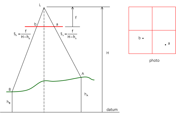 |
| Figure C-6 Point Scale |
b. Linear Scale
If two points have the same elevation and their horizontal ground distance is known, the linear scale between them can be computed with Equation C-2.
 |
Equation C-2 |
Figure C-7 shows the geometry of scale determination for two different coordinate pairs.
The linear scale is only correct at the elevation of the end points. If the terrain elevation decreases or increases between end points, so does the scale. Equation C-2 is useful only for flat terrain or over very short distances.
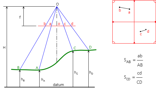 |
|
Figure C-7 Linear Scale |