2. Relief Displacement
A traditional paper, or contemporary digital, map has a constant horizontal scale throughout. Planimetric information is elevation-free making scale elevation-free.
That's not the case for an aerial photo because of its optical geometry, Figure H-3.
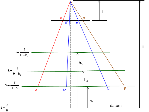 |
| Figure H-3 Elevation Dependent Scale |
Recall that relief displacement, caused by height difference, is radial from the photo's principal point. The amount of displacement is a function of height difference and principal point proximity, Figure H-4.
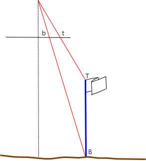 |
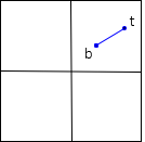 |
| (a) Object | (b) Photo images |
| Figure H-4 Relief Displacement |
|
To convert a photo to a map, its images must all be projected vertically to datum, Figure H-5. This draws them in radially toward the principal point.
|
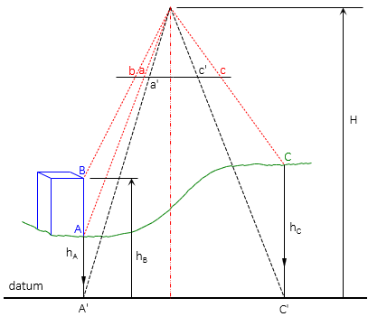
Figure H-6 shows the effect of projecting objects in Figure H-5 to datum (positions in black).
 |
| Figure H-6 Projected Positions |
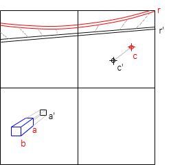
Because an elevation is a height, ground points projected to datum are also shifted radially. Some straight objects, such as roads, powerlines, etc, may appear curved on the photo depending on their elevation profile and orientation.
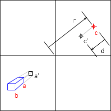
The radial shift can be determined using Equation H-1
| Equation H-1 |
Distances r and d are shown on Figure H-7.
 |
| Figure H-7 Radial Shift |