Page 1 of 3
D. The North American Datum
1. History
The evolution of the North American datum is interesting, a bit convoluted, and a continuing process. Expansion of the spatial data user community and more accurate measurement technology increases pressure on the control network to meet ever greater accuracy needs. What used to take decades between datum refinements is reduced to years.
This chapter highlights major events in the North American datum history. For greater detail, the reader is directed to reference list included in Chapter A.
Note: Click any map to see a larger version
New England Datum - 1879
- Network: Along Eastern Coast and in Northeastern states
- Ellipsoid: Clarke 1899
- Origin: Control station Principio in Maryland
US Standard Datum - 1901
- Network: Extended network south and west; later added Transcontinental and Pacific arcs, Figure D-1
- Approximately 5,000 control stations
- Ellipsoid: Clarke 1866
- Origin: Meades Ranch in Kansas, Figure D-2, is identified as the origin but its position was computed from Principio; Azimuth to point Waldo fixed orientation.
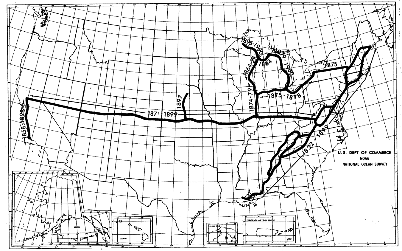 |
| Figure D-1 Control Network in 1901 “A Potpourri of Geodetic and Other Surveying Items”, Joseph F. Dracup Presented at the WSLS Annual Institute Jan 1977 |
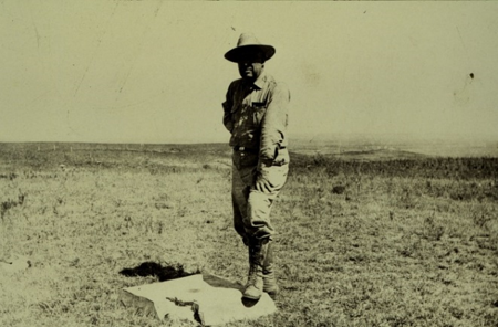 |
| Figure D-2 Control Station Meades Ranch NGS Photograph Archives |
North American Datum - 1913
- Canada and Mexico agree to tie their networks to the network. To reflect this, the US Standard Datum renamed the North American Datum. Nothing else changed.
North America Datum of 1927 (NAD 27) - 1932
- Network: 1901 US network expanded, Figure D-3; Canadian and Mexican networks added.
- Approximately 25,000 control stations
- Ellipsoid: Clarke 1866
- Origin: Control station Meades Ranch (as computed from Principio); Azimuth to Waldo
- Adjustment completed in 1932
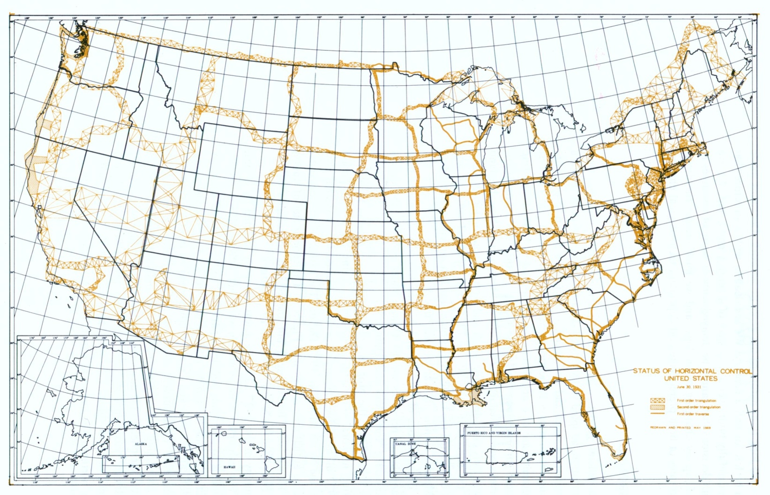 |
| Figure D-3 NAD 1927 Network “North American Datum of 1983”, Charles R. Schwartz, Editor, NOAA Professional Paper NOS 2, Dec 1989 |
North America Datum of 1983 (NAD 83) - 1986
- Network: Fifty years worth of additional densification, Figures D-4 and D-5
- Approximately 272,000 control stations
- Ellipsoid: Geodetic Reference System of 1980 (GRS 80)
- Origin: Geocentric fit
- Adjustment completed in 1986
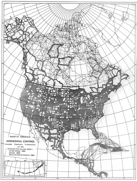 |
| Figure D-4 North American Control Network in 1969 “North American Datum” National Academy of Sciences, 1971 |
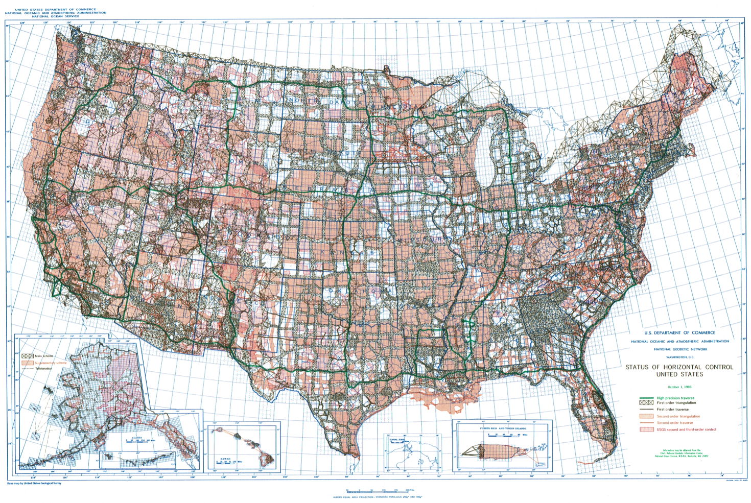 |
| Figure D-5 NAD 1983 Network NGS Website |