1. What is Scale?
Scale has two meanings in the context of precision drawings, including maps.
a. Map-Ground Relationship
Scale is the dimensional proportion of an object's representation and the object's size.
In Figure C-1, one inch on the map is 200 feet on the ground.
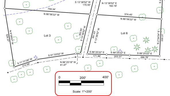 |
| Figure C-1 Scale: Proportion |
b. Measuring Device
(1) General
A scale is device with a series of evenly ordered marks that is used to measure drawing objects. In its most basic form, called a ruler, it usually has inches and fractions thereof along an edge, with possibly a second set of divisions in centimeters and millemeters along another.
In surveying and engineering we call the device a scale. It can have one or more differently spaced division series along its edges. The scale in Figure C-2 has two sets of marks: 10 divisions per inch and 20 division per inch. These are referred to as the 10-scale and 20-scale.
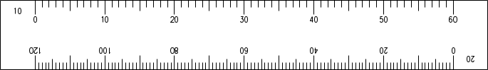 |
| Figure C-2 Scale: Measuring Device |
Multiple division sets allow direct measurement on map with a matching numeric scale. Because the scale of the map in Figure C-3 is 1"=200', the 20-scale is used to make measurements.
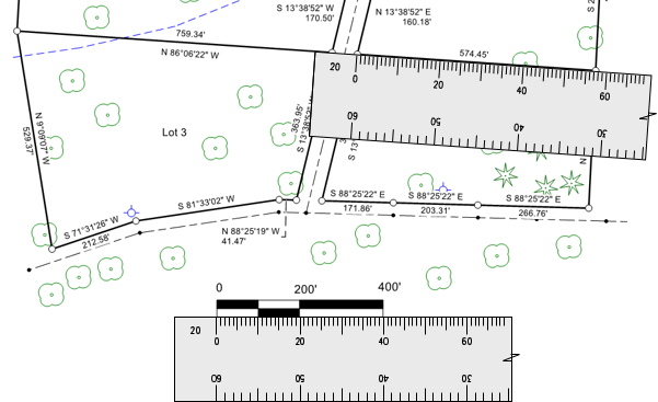 |
| Figure C-3 Scaling Distances |
Using an appropriate scale allows distances to be plotted or measured without having to perform calculations.